aerosquad.in

Author name: aravindhjaguar111@gmail.com

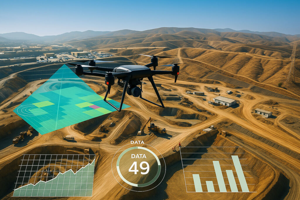
Drone-as-a-Service (DaaS): Why Outsourcing Aerial Ops Saves 60% on Operational Costs

Introduction Running an in-house drone operation comes with high startup costs, regulatory burdens, pilot training, and maintenance issues. Drone-as-a-Service (DaaS) offers an agile, cost-effective solution by outsourcing all these complexities to experienced drone providers like Aerosquad. 1. What Is Drone-as-a-Service (DaaS)? DaaS is a business model where clients subscribe to drone services rather than owning or operating them. 2. Hidden Costs of In-House Operations For most companies, these can exceed ₹1 crore/year easily. 3. How DaaS Delivers 60% Savings Example: A logistics company outsourced warehouse inventory drone monitoring. 4. DaaS Use Cases 5. Why Aerosquad for DaaS? 6. ROI + Agility DaaS not only cuts costs but also increases agility: Conclusion Drone-as-a-Service is not just a cost-saving model—it’s a growth accelerator. With up to 60% in operational savings, businesses that adopt DaaS early will outpace competitors. CTA: 📦 Start Saving with DaaS Today Request a free consultation with Aerosquad’s Drone-as-a-Service team. 📧 support@aerosquad.in | 🌍 www.aerosquad.in

How Industrial Drones Are Delivering 3X ROI in Infrastructure and Energy Inspections

Introduction In the fast-evolving landscape of infrastructure and energy, companies are under increasing pressure to deliver safer, faster, and more cost-efficient operations. Traditional inspection methods are not only time-consuming but also expensive and risky. Enter industrial drones—these unmanned aerial systems are changing the game by offering 3X ROI through real-time data, minimal downtime, and enhanced safety. 1. The High Cost of Traditional Inspections Manual inspections of pipelines, wind turbines, powerlines, and bridges involve large teams, equipment rentals, road closures, and extensive downtime. Human inspections can cost thousands per day—and still miss critical details due to limited access or visibility. 2. What Makes Drones So Efficient? 3. 3X ROI: Real-World Example A renewable energy company integrated industrial drones into its wind turbine inspections. 4. ROI Breakdown 5. Industries Benefiting the Most 6. Aerosquad’s Drone Inspection Program At Aerosquad, we specialize in turnkey drone inspection services: Conclusion Industrial drones are no longer a futuristic idea—they are a proven investment. With the potential to triple ROI, now is the time for infrastructure and energy companies to take action. CTA: 🚀 Ready to upgrade your inspection process? Book a free demo with Aerosquad’s drone experts and discover how much you can save. 📧 support@aerosquad.in | 🌐 www.aerosquad.in

Smart Farming: Agricultural Drone Services in Coimbatore

Agriculture remains the backbone of Tamil Nadu, and Coimbatore is no exception. But with rising input costs, labor shortages, and unpredictable weather, traditional farming methods are under pressure. Aerosquad offers agricultural drone services in Coimbatore that help farmers and agribusinesses adopt smarter practices. From crop spraying to NDVI mapping, our drones assist in every stage of cultivation. These aerial services reduce chemical wastage, save time, and protect farmers from direct exposure to pesticides. Using multispectral sensors, our drones assess crop health, detect stress zones, and identify areas needing intervention. For large farms, this means targeted irrigation, fertilization, and pest control—leading to higher yields and lower costs. Our drone spraying services cover up to 30 acres per hour, applying exact doses and avoiding overlaps. NDVI-based health maps help in early disease detection and harvest planning. Aerosquad also provides field boundary mapping, irrigation planning, and terrain evaluation, especially useful for sugarcane, paddy, and banana farms around Coimbatore.

Drone Survey for Infrastructure Projects in Coimbatore

In Coimbatore’s fast-evolving landscape, infrastructure projects demand speed, precision, and adaptability. Be it a highway, flyover, sewage treatment plant, or a smart city initiative accurate site data is the foundation. Aerosquad offers drone surveying solutions tailored for infrastructure development, eliminating the delays and inconsistencies of traditional survey methods. Our drones collect centimeter-level accurate data with geotagged imagery, helping civil engineers, architects, and planners gain clear, actionable insights. The result? Faster project approvals, fewer design errors, and lower costs Our infrastructure drone surveys generate topographic maps, digital elevation models, 3D terrain reconstructions, and contour maps. These outputs are critical for slope analysis, drainage planning, earthwork estimation, and structural placement. For large projects like ring roads or public utilities, our drones can fly over hundreds of acres, even in difficult terrain, producing reports within 24 hours. In Coimbatore’s monsoon-prone zones, this real-time data helps teams make weather-based decisions faster and prevent work halts. With drone survey integration into AutoCAD and GIS tools, designers get highly accurate ground overlays that match real-world conditions

Drone Solar Inspection Service in Coimbatore

With Tamil Nadu leading the way in renewable energy adoption, Coimbatore has seen a rise in solar farms and rooftop installations. But with growth comes the need for proper maintenance. Traditional solar panel inspections are time-consuming, labor-intensive, and potentially risky. Aerosquad offers a smarter solution through drone-based solar inspections. Our drones, fitted with thermal imaging cameras, scan hundreds of panels within minutes—detecting hotspots, dirt build-up, shading issues, and cell-level faults. This proactive monitoring not only improves energy yield but also extends the life of the solar setup.

Elevate Real Estate Marketing: High-Quality Drone Plot Videos in Coimbatore

In today’s fast-moving property market, standing out from the crowd is no longer a luxury—it’s a necessity. Traditional photography and walk-throughs often fall short in highlighting the true potential of a real estate plot. That’s where drone real estate videos come into play. Aerosquad, Coimbatore’s leading drone service provider, delivers high-definition, cinematic aerial videos that capture every inch of a plot from stunning angles. From boundary coverage to panoramic overviews, our drones offer buyers a complete understanding of the property’s location, surroundings, and layout—something flat photos simply can’t achieve. These videos are not only impressive but also help build trust with buyers by providing a transparent, birds-eye view of the land.

Instant Insights: Best Drone Mapping Company in Coimbatore

What sets Aerosquad apart is not just the use of cutting-edge drone technology but the end-to-end solutions provided. With geotagged imagery, 2D and 3D orthomosaic maps, digital elevation models (DEMs), and contour maps, clients receive comprehensive, ready-to-use data. For real estate developers, drone survey outputs support site analysis and marketing; for engineers, they help validate architectural blueprints and detect early-stage errors. Additionally, in agricultural zones surrounding Coimbatore, drone surveys help in land profiling, soil health analysis, and irrigation planning. Aerosquad’s clients report up to 70% time savings and enhanced decision-making due to real-time insights. The precision and depth of drone data have made Aerosquad the go-to survey partner for Coimbatore-based infrastructure, industrial, and governmental projects.

Revolutionizing Land Surveys: Drone Survey Services in Coimbatore

Traditional land surveying methods often involve manual equipment, high labor costs, and time-consuming processes. In a fast-growing city like Coimbatore, where infrastructure and real estate development are booming, time-efficient and precise solutions are crucial. This is where drone survey services, like those offered by Aerosquad, step in to revolutionize the surveying industry. Using high-resolution cameras and GPS-enabled drones, Aerosquad provides highly accurate data in a fraction of the time it takes traditional survey teams. These drones can fly over uneven terrain, inaccessible zones, and large land parcels, capturing data in minutes that would otherwise take days. For construction, agriculture, and land planning projects in Coimbatore, this evolution has been a game-changer, offering both speed and savings.