

Industries
Direct georeferencing from the air and Accurate position on the ground.
Image by freepik
Industry Expertise
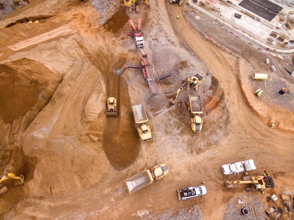
Assist the construction industry in obtaining fast and reliable visual data of a site. Land Surveying information enables our clients to improve safety, make changes, and increase project efficiency. We provide data from aerial imagery to project managers for real-time construction monitoring.
It’s never been easier to keep track of projects and their progress. With professional aerial drone cinematography, you can see how your projects are moving ahead from the sky. Use the images to track specific elements of a project, to map out locations, or to create promotional or brand management components.
Why prefer Aerosquad?
Aerosquad might be the only firm that utilizes both total facility and company grade DGPS base stations at the same time to verify the entire land record with RTK drones for 100% high precision.
Extended Support
Saving and cost - effective Survey
Speed Reporting
Best Price Assured
Industry Offers
Infrastructre
Drone solutions that deliver analytical geospatial information will shape the smart cities of the future by way of smart land-use governance, digitization of land records and near real-time 3-Dimensional infrastructure insights.
Transport
Drone surveying allows for quick and accurate mapping of road and highway projects. Offer the best services drone surveys provide data needed for junction planning, by pass design, and lane extension on existing highways.
Agriculture
Agricultural uav are unmanned drone vehicles that support in crop yields, crop growth monitoring, and implementation efficiency. Farmers benefit greatly from our sensors and digital imaging capabilities, which provide precise data.
Mining
AI-powered surveys can track production from pit to stockpile, digital terrain models can measure mine progress, and critical infrastructure can be protected – all in the cloud.aerial monitoring solution, mine operators can automate time-consumes.
Agriculture
Agricultural uav are unmanned drone vehicles that support in crop yields, crop growth monitoring, and implementation efficiency. Farmers benefit greatly from our sensors and digital imaging capabilities, which provide precise data.
Wind-Turbine
The Drone task environment aid in the preservation of wind turbines, which is critical at various points in the project life span. It facilitates all parties involved to be confident in the quality of the turbine's preparation, servicing, and efficiency.
Mining
AI-powered surveys can track production from pit to stockpile, digital terrain models can measure mine progress, and critical infrastructure can be protected – all in the cloud.aerial monitoring solution, mine operators can automate time-consumes.
Oil and gas
Drone Inspection Services for Powerlines and transmission towers are assets that require and diagnosis to ensure minimal loss of energy. effective drone solutions provide a better way to reduce the losses that this energy produces and transfers.
Infrastructre
Drone solutions that deliver analytical geospatial information will shape the smart cities of the future by way of smart land-use governance, digitization of land records and near real-time 3-Dimensional infrastructure insights.
Transport
Drone surveying allows for quick and accurate mapping of road and highway projects. Offer the best services drone surveys provide data needed for junction planning, by pass design, and lane extension on existing highways.
Agriculture
Agricultural uav are unmanned drone vehicles that support in crop yields, crop growth monitoring, and implementation efficiency. Farmers benefit greatly from our sensors and digital imaging capabilities, which provide precise data.
Mining
AI-powered surveys can track production from pit to stockpile, digital terrain models can measure mine progress, and critical infrastructure can be protected – all in the cloud.aerial monitoring solution, mine operators can automate time-consumes.
Wind-Turbine
The Drone task environment aid in the preservation of wind turbines, which is critical at various points in the project life span. It facilitates all parties involved to be confident in the quality of the turbine's preparation, servicing, and efficiency.
Oil and gas
Drone Inspection Services for Powerlines and transmission towers are assets that require and diagnosis to ensure minimal loss of energy. effective drone solutions provide a better way to reduce the losses that this energy produces and transfers.